
How to Build a Wayfinding Master Plan for a Complex Facility
A wayfinding master plan is a coordinated strategy that defines how people navigate a building, campus, or complex facility. It establishes destination hierarchies, circulation routes, navigation decision points, signage standards, accessibility considerations, implementation priorities, and long-term management responsibilities. Unlike a sign schedule, which documents individual signs, a master plan governs how the complete navigation system should function.
For facilities containing multiple buildings, entrances, parking areas, departments, or circulation routes, effective wayfinding requires more than installing directional signs wherever visitors become confused. Individual signs may convey accurate information, yet the overall journey remains difficult to understand. Building names may differ between maps and directories, accessible connections may be unclear, and renovations may create contradictory directions.
A properly developed master plan addresses these relationships before signage is fabricated. It establishes which destinations matter, how routes should be organized, where information is required, and which stakeholders must approve the resulting decisions.
The U.S. Department of Veterans Affairs’ Signage Design Manual recognizes this distinction by separating master planning from detailed signage programming. Its guidance describes how information hierarchy, circulation planning, and signage standards create a foundation for consistent implementation and future updates.
This guide explains how facilities managers, architects, project owners, and signage teams can develop a practical wayfinding master plan, translate navigation problems into documented requirements, coordinate implementation, and evaluate the finished system.
What Is a Wayfinding Master Plan?
A wayfinding master plan is a documented framework for organizing navigation across a facility or campus. It defines how destinations are named, how people move between them, where navigation information is needed, and how physical signage, environmental features, and digital information should work together.
The central purpose of a master plan is to make complex environments easier to understand.
Consider a campus containing administrative offices, public services, parking structures, pedestrian connections, and restricted operational areas. A first-time visitor must identify the correct parking location, find the intended building, enter through an appropriate entrance, and navigate to the final destination.
Each stage involves a navigation decision. A master plan establishes how those decisions should be supported and how information should remain consistent across the entire journey.
This approach applies to hospitals, universities, corporate campuses, transportation facilities, retail developments, industrial complexes, and other environments where multiple destinations share an interconnected circulation network.

Coordinated wayfinding across multi-building campus facilities.
How is a wayfinding master plan different from a sign schedule?
A wayfinding master plan establishes the navigation strategy, while a sign schedule documents the physical signs developed to implement it.
The documents are connected but serve different purposes.
A master plan defines the destination hierarchy, circulation principles, information requirements, wayfinding zones, and signage standards.
A sign schedule identifies specific signage elements, including their locations, messages, sign types, dimensions, and other implementation details.
A third documentation layer records the completed installation and supports future changes.
| Documentation layer | Primary function | Typical deliverables |
| Strategic master plan | Establish how navigation should work | Route hierarchy, destination naming, information strategy, design principles |
| Implementation documentation | Translate strategy into physical requirements | Sign-location plans, message schedules, specifications, fabrication drawings |
| Operational documentation | Maintain the completed system | As-installed inventory, inspection records, change-control register |
The distinction is important because building conditions and destination information may change between strategic planning and installation.
The VA’s Signage Design Manual, Section 2.1.2, identifies location plans, message schedules, and sign drawings as the main components of signage programming. It also explains why detailed programming should occur sufficiently close to implementation to avoid errors caused by changing information or building conditions.
Although the manual governs projects within its defined scope, this separation provides a useful model for other complex facilities.
What problems does a wayfinding master plan solve?
A wayfinding master plan addresses navigation problems involving several routes, destinations, information sources, or physical environments.
Common problems include inconsistent building names, unclear entrances, disconnected circulation paths, outdated directories, conflicting directional signs, and poorly coordinated renovation phases.
These issues may not be solved by replacing individual signs.
For example, a facility may call the same destination “Public Services” on an older corridor sign and “Visitor Services” in its current directory.
Replacing the corridor sign without confirming the approved destination name may simply introduce another inconsistency.
A master plan creates a controlled process for determining the correct terminology and applying it across relevant information channels.
It also identifies situations where the appropriate response may involve changes to circulation, lighting, entrances, or operational procedures rather than additional signage.
What should a completed master plan establish?
A completed wayfinding master plan should define the facility’s navigation objectives, major destinations, primary routes, information hierarchy, signage design principles, implementation priorities, and responsibilities for future updates.
It should also identify outstanding decisions and assign them to appropriate stakeholders.
The plan does not necessarily need to contain final fabrication drawings for every future sign.
Instead, it should establish sufficiently clear requirements so that those drawings are developed consistently when implementation begins.
For an introduction to the broader role of physical signage, BlinkSigns’ Complete Guide to Wayfinding Signage covers the common categories of identification, directional, and informational signage. The master-planning process develops those concepts into a coordinated facility-wide strategy.
When Does a Complex Facility Need a Wayfinding Master Plan?
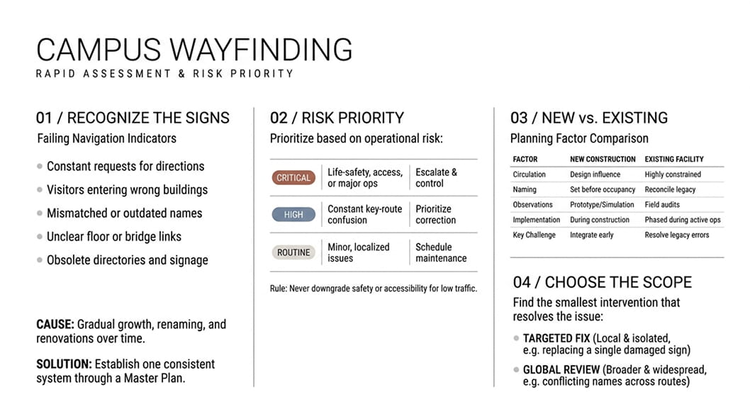
Assessing navigation risks and planning scope.
A complex facility should consider developing or updating a wayfinding master plan when navigation problems affect multiple buildings, routes, visitor groups, or information systems. Major construction, renovations, expansions, rebrandings, departmental relocations, and persistent visitor confusion are common reasons to reassess the existing system.
However, not every signage problem requires comprehensive master planning.
The appropriate intervention depends on the scale of the problem, its operational importance, and the extent to which other routes or destinations are affected.
Recognize signs of a failing navigation system
Recurring requests for directions, visitors entering the wrong buildings, inconsistent destination names, unclear floor connections, and outdated directories can indicate weaknesses in the broader wayfinding system.
These problems often develop gradually.
A department changes its name, but only its entrance sign is updated. A renovation changes pedestrian circulation, while the parking directory continues showing the previous route. A new building introduces terminology different from that of the surrounding campus.
Eventually, the facility contains several overlapping navigation systems rather than one consistent information structure.
A master plan can identify these relationships and establish a coordinated solution.
Prioritize problems according to operational risk
Wayfinding problems should be prioritized based on their consequences, frequency, and impact on users.
A confusing sign near a secondary meeting room may warrant correction. Still, a navigation problem affecting an accessible entrance, a major public route, or an important arrival location may require more urgent attention.
A practical prioritization model can classify findings into three groups.
| Priority | Typical condition | Recommended response |
| Critical review | Possible accessibility, life-safety, or significant operational consequence | Escalate to the responsible qualified reviewer and establish necessary controls |
| High | Repeated confusion affecting important destinations or multiple routes | Prioritize investigation and corrective planning |
| Routine | Localized message, condition, or maintenance issue with limited route impact | Address through the approved maintenance or improvement program |
This is a recommended project-management model, not an official regulatory risk classification.
An apparent safety or accessibility problem should not be downgraded merely because it affects relatively few visitors.
New construction versus existing facilities
New construction and existing facilities require different approaches to wayfinding planning.
During new construction, project teams may be able to influence entrance locations, circulation hierarchy, building connections, directory locations, and architectural landmarks.
In an existing facility, the team must work with established circulation, inherited signage, operating departments, and potentially inconsistent building layouts.
| Planning factor | New construction | Existing facility |
| Circulation design | Can often be influenced during architectural planning | Usually constrained by existing conditions |
| Destination naming | Can be established before occupancy | May require reconciliation of established terminology |
| User observations | Models, prototypes, and simulated journeys | Existing-route observation and field testing |
| Signage inventory | Limited or absent | Existing signs require auditing |
| Implementation | Coordinated with construction | May require phased work during operations |
| Principal challenge | Integrating wayfinding before design decisions become fixed | Correcting accumulated inconsistencies without unnecessary disruption |
A renovation may involve both conditions. New construction can establish improved circulation, while connections to existing buildings must remain understandable.
When is a targeted signage improvement sufficient?
A limited signage intervention may be appropriate when the problem is isolated, and the wider destination hierarchy remains accurate.
For example, one damaged building identifier may require replacement rather than a new campus-wide master plan.
However, if several signs use conflicting building names, the issue may require a broader review of destination information.
Before determining the scope, the project team should establish whether the proposed correction affects other signs, routes, maps, or communication channels.
The recommended principle is to choose the smallest intervention that adequately resolves the verified problem.
Who Should Be Involved in Wayfinding Master Planning?
A wayfinding master plan should involve facility ownership, project management, architecture, wayfinding design, accessibility review, operations, and relevant signage specialists. Their responsibilities should be defined before detailed design begins so that navigation decisions, technical reviews, and approvals remain coordinated.
Wayfinding projects cross several organizational boundaries.
Facilities management understands existing building conditions. Operations teams know how visitors and employees use the space. Architects understand circulation and architectural constraints. Wayfinding specialists organize navigation information, while signage suppliers contribute fabrication and installation expertise.
These responsibilities should complement one another rather than overlap without clear ownership.
Establish the project team
A typical complex-facility project may involve a facility owner, project manager, architect, wayfinding designer, accessibility specialist, signage supplier, and facilities operations representative.
Additional stakeholders may be needed for transportation, security, digital navigation, clinical operations, or other specialized environments.
The exact structure depends on project scope and contractual arrangements.
A signage manufacturer should not automatically be assumed responsible for architectural design, accessibility certification, traffic engineering, or regulatory approval.
Use a RACI matrix to define accountability
A RACI matrix clarifies who performs the work, who is accountable for decisions, who must be consulted, and who needs to be kept informed.
The four designations are:
R: Responsible for performing the activity.
A: Accountable for the decision or outcome.
C: Consulted during the process.
I: Informed about the outcome.
For the following illustrative matrix:
FO = Facility Owner; PM = Project Manager; WD = Wayfinding Designer; AR = Architect; AX = Accessibility Specialist; SS = Signage Supplier; OP = Facilities Operations.
| Project activity | FO | PM | WD | AR | AX | SS | OP |
| Approve project objectives | A | R | C | C | C | I | C |
| Approve public destination names | A | C | R | C | C | I | C |
| Develop circulation strategy | I | A | R | R | C | I | C |
| Coordinate accessibility assessment | I | R | C | A | R | C | C |
| Develop signage standards | I | A | R | C | C | C | C |
| Prepare sign-location documents | I | A | R | C | C | R | C |
| Authorize fabrication | A | R | C | C | C | I | C |
| Coordinate installation | I | A | C | C | C | R | C |
| Complete navigation commissioning | A | R | R | C | C | C | C |
| Maintain destination information | I | I | C | I | C | C | A/R |
This matrix is illustrative. Actual professional accountability, contractual authority, and legally required approvals must be established for the individual project.
The value of a RACI matrix lies in preventing uncertainty.
If two departments disagree about a public-facing destination name, the project should already identify who has authority to approve the final terminology.
Establish formal decision gates
Critical wayfinding decisions should be documented before dependent work begins.
For example, the project should not authorize fabrication of a directional sign when its destination name remains disputed.
Likewise, a proposed accessible route should not be approved merely because it appears continuous on a floor plan.
The project manager should maintain an approval register that identifies the decision, the responsible reviewer, the supporting evidence, the approval date, and any outstanding conditions.
The VA Signage Design Manual provides an institutional example of coordinated wayfinding planning and formal signage programming documentation.
Downloadable Resource: Download the Wayfinding Master Plan Excel Toolkit
(open the RACI Matrix tab to customize project roles, approval authorities, and sign-off gates for your facility).
How Do You Audit Existing Wayfinding and Circulation?
A wayfinding audit evaluates how people currently navigate a facility, where they encounter difficulties, and whether existing signs, directories, architectural features, and route information support their journeys. The assessment should identify the underlying cause of navigation problems before recommending additional signage.
A physical sign inventory is part of the audit, but it does not replace an examination of complete routes.
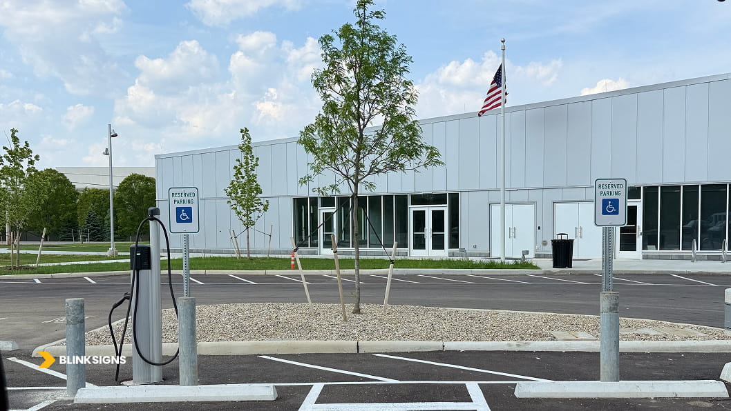
Auditing accessible parking and circulation routes.
Collect current facility information
The audit should begin with available site plans, floor plans, parking layouts, destination inventories, building connections, accessibility documentation, and records of planned operational changes.
These documents provide a starting point.
Field verification is still necessary because drawings may not reflect current conditions.
Entrances may have changed functions, departments may have relocated, and temporary construction routes may have become established circulation patterns.
The audit should distinguish public, employee, service, restricted, and relevant accessible routes.
Create an origin-and-destination inventory
An origin-and-destination inventory identifies the important journeys that the facility must support.
Origins may include visitor parking, public transit connections, pedestrian entrances, reception desks, elevators, and connecting buildings.
Destinations may include departments, meeting rooms, service counters, classrooms, clinics, or other spaces.
The inventory should identify user groups and the routes relevant to each.
This prevents the audit from focusing exclusively on the main entrance while overlooking secondary entrances, service access, or departure routes.
Observe actual navigation behavior
A facility should observe representative users completing realistic navigation tasks where practical.
Participants may be asked to locate a department from a parking area, identify a particular entrance, or find a designated service counter.
Observers should document hesitation, wrong turns, requests for assistance, and situations where participants misunderstand existing information.
The published SEGD study A Framework for Evaluating Wayfinding Systems used participant questionnaires, route walkthroughs, and navigation tasks to examine an existing university athletic complex. Its small exploratory sample included eight participants, five of whom had not previously visited the facility. The study illustrates how observations can identify weaknesses in signage, maps, and architectural circulation, but it does not establish universal performance outcomes.
Testing should be conducted with appropriate permissions and privacy safeguards. Personal information and identifiable recordings should not be collected unnecessarily.
Document problems with sufficient evidence
Each audit finding should identify its location, affected journey, observed issue, supporting evidence, operational significance, and recommended next action.
Consider an illustrative three-building institutional campus:
Building A: Administration and Central Reception.
Building B: Visitor Services Department and other public services.
Building C: Specialized services and controlled operational areas.
The campus has two visitor parking areas, including Parking P2. A planned renovation will temporarily affect part of the pedestrian approach to Building B.
An initial audit identifies inconsistent terminology at the ground-floor lobby junction of Building B.
| Audit record | Illustrative value |
| Finding ID | A-014 |
| Location | Building B, ground-floor lobby junction |
| Affected journey | J-003 |
| Observed issue | Existing sign reads “Public Services” |
| Intended destination | Visitor Services Department |
| Evidence | Sign photograph, directory comparison, route observation |
| Severity | High, pending facility review |
| Recommended action | Confirm approved public name and review affected directions |
| Responsible owner | Facility wayfinding lead |
| Disposition | Open until naming review |
This record identifies the problem without assuming that a new sign is necessarily required.
Distinguish signage problems from architectural problems
A wayfinding audit should determine whether confusion results from information, physical circulation, or both.
A missing directional sign may be corrected through signage.
An inaccessible connection, hidden entrance, or corridor that terminates unexpectedly may require architectural or operational action.
Research published in Visible Language, Map Design for Complex Architecture: A User Study of Maps & Wayfinding, found that maps can help people navigate complex buildings but may not overcome architectural barriers.
The audit should therefore record whether the proposed response belongs to signage design, facility operations, architecture, accessibility review, or another responsible discipline.
How Do You Map User Journeys and Decision Points?
User journey mapping identifies where people begin, where they need to go, the available routes, and the decisions required along the way. Each important journey should be documented so the project team can determine what information users need and where it should appear.
Journey mapping should reflect how visitors experience the facility, not merely how circulation appears on a drawing.
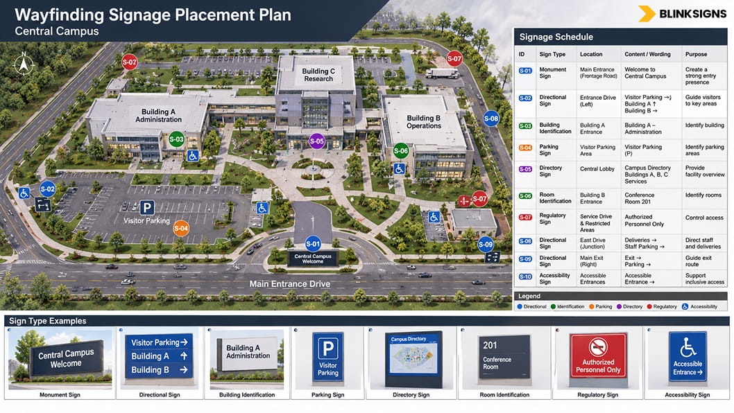
Campus placement plan mapping decision points.
Identify user groups and representative journeys
A complex facility may serve first-time visitors, employees, students, patients, contractors, delivery personnel, and people who require particular accessible routes.
Their destinations and permitted circulation paths may differ.
A public visitor may enter through a main reception area, while a contractor may use a designated service entrance.
The master plan should identify the journeys that matter to each user group without presenting restricted routes as ordinary public alternatives.
Map arrivals, transfers, and return journeys
A complete route inventory should cover more than arrival at the final destination.
Visitors may need to return to the parking area, move between departments, reach a pickup location, or exit through a different public entrance.
For the illustrative campus, a representative journey is:
J-003: Visitor Parking P2 to the Visitor Services Department in Building B.
The current intended route is:
Parking P2 → Building B East Entrance → Ground-floor lobby → Visitor Services Department.
The return journey follows the approved public route back toward Parking P2.
These routes must be checked for actual circulation conditions and applicable accessibility requirements.
Identify decision points and confirmation points
A decision point is a location where a user must choose among possible routes.
A confirmation point provides reassurance that the user remains on the correct route.
For journey J-003, the important internal decision occurs at the junction of Building B’s ground-floor lobby.
This location is assigned identifier DP-017.
The visitor must understand which direction leads toward Visitor Services.
The project team should examine whether the existing architecture, directory, and directional information communicate that decision.
A missing or conflicting message should be addressed based on the observed problem, rather than automatically by adding additional signage.
Maintain a clear journey reference
| Field | Illustrative value |
| Journey ID | J-003 |
| User group | First-time public visitor |
| Origin | Visitor Parking P2 |
| Destination | Visitor Services Department, Building B |
| Current entrance | Building B East Entrance |
| Internal decision point | DP-017 |
| Related audit finding | A-014 |
| Current problem | Inconsistent department terminology |
| Temporary construction issue | Planned east courtyard approach closure |
| Alternative route | Under review, not yet approved |
| Commissioning requirement | Test arrival and return journeys |
This becomes the reference record for subsequent planning, implementation, and maintenance decisions.
Test alternative routes before approving them
Alternative routes should be evaluated for actual availability, access restrictions, usability, and applicable accessibility requirements.
For the illustrative campus, the planned renovation may require visitors from P2 to use a perimeter pedestrian connection before reaching the East Entrance of Building B.
That route remains a candidate until the facility completes the necessary reviews.
It should not be described as an approved accessible route or published in visitor instructions before verification.
If the alternative route changes the building entrance or bypasses DP-017, the original journey and affected sign requirements must be reassessed.
Use progressive disclosure
Wayfinding information should become more specific as visitors approach their destinations.
At the campus entrance, visitors may need to identify Building B.
Near the building, they may need to identify the East Entrance.
Inside, the next relevant instruction may direct them toward Visitor Services.
The SEGD article “Wayfinding Is Where Place Meets Information Design” describes this progression as a means of providing people with information when it becomes relevant to their navigation decisions.
A wayfinding master plan should organize information according to that sequence rather than display every destination at every intersection.
How Do You Establish Destination Names, Zones, and Information Hierarchies?
A destination hierarchy organizes facility information from broad locations to specific destinations using approved names and consistent spatial relationships. It helps visitors understand how campuses, buildings, entrances, floors, departments, and rooms connect.
The hierarchy should be established before final sign messages are developed.
Create a destination naming register
A destination register should identify each important location, its approved public name, relevant aliases, physical location, and responsible owner.
This helps prevent departments from introducing competing names across signs and directories.
On the illustrative campus, the existing Building B corridor sign reads “Public Services,” whereas current facility communications refer to “Visitor Services.”
The master plan must resolve the naming conflict.
For the worked example, assume the authorized facility owner reviews the terminology and approves Visitor Services as the public-facing name under fictional approval record G-NAME-01.
This approval is part of the illustrative scenario, not an actual project record.
The sign schedule can now use the approved name without treating the original audit finding as unresolved.
Establish the information hierarchy
A practical hierarchy may progress through the following levels.
| Level | Illustrative destination | Communication context |
| Campus | Central Campus | Site approach |
| Building | Building B | Campus navigation |
| Entrance | East Entrance | Pedestrian approach |
| Floor | Ground Floor | Interior orientation |
| Department | Visitor Services | Interior directions |
| Room | B-214 | Final room identification |
Not every sign needs to display every level.
The hierarchy determines which information is useful at each stage.
The VA Signage Design Manual, Section 1.2.3, describes organizing campuses into recognizable regions, buildings, entrances, parking locations, floors, and destination groups to simplify navigation.
Use zones only where they improve navigation
Zones can help organize large facilities when buildings or departments contain several distinguishable areas.
However, introducing unnecessary zones can add complexity.
A small campus already organized into Buildings A, B, and C may not require an additional color-coded zoning system.
Where zones are useful, their names and visual identifiers should remain consistent across relevant signs, maps, and directories.
Color should reinforce written information rather than serve as the sole means of distinguishing destinations.
Establish naming rules for floor transitions
Complex facilities may contain connecting buildings with different floor relationships.
A pedestrian corridor may connect the second floor of one building with the ground floor of another.
The master plan should document these conditions and establish how the transitions will be communicated.
Floor numbering and destination labels should be verified against actual circulation rather than assumed from architectural plans alone.
Control future changes
The destination register should have an identified owner and revision history.
When a department changes its name or location, the facility should determine which signs, directories, maps, and visitor instructions require updates.
This makes the destination hierarchy an operational reference rather than a document used only during initial design.
How Do You Turn Wayfinding Routes Into Signage Requirements?
Wayfinding routes are converted into signage requirements by identifying navigation decisions, defining the information needed at each location, evaluating possible interventions, and documenting approved physical signage requirements for implementation.
A decision point identifies an information need. It does not automatically establish that a new sign must be installed.
This distinction helps facilities avoid treating the quantity of signs as a substitute for navigation quality.
Begin with the observed problem
For the illustrative campus, the audit identifies inconsistent terminology at the lobby junction of Building B.
The relevant records are:
A-014: Existing-condition finding.
J-003: Visitor journey from Parking P2 to Visitor Services.
DP-017: Ground-floor lobby decision point.
The visitor needs to identify the correct route toward Visitor Services.
The first task is to determine whether the existing information adequately supports that decision.
Evaluate possible interventions
The project team should consider whether the problem can be resolved by correcting an existing message, improving a directory, changing sign placement, or modifying other navigation information.
A new sign should be selected only when it is an appropriate response to the verified need.
In this example, assume the facility determines that the existing wall-mounted directional sign can be replaced with an updated message.
The proposed replacement is assigned candidate sign ID S-042.
The approved public-facing destination name is now “Visitor Services,” per the fictional naming approval G-NAME-01.
The sign’s precise location, mounting conditions, message layout, and technical requirements still require implementation approval.
Complete route-to-sign traceability record
| Planning stage | Reference | Decision or evidence |
| Existing-condition audit | A-014 | Outdated “Public Services” message observed |
| User journey | J-003 | Parking P2 to Visitor Services, Building B |
| Decision point | DP-017 | Ground-floor lobby junction |
| Information requirement | IR-017 | Identify the correct direction toward Visitor Services |
| Naming approval | G-NAME-01 | “Visitor Services” approved within the illustrative scenario |
| Intervention evaluation | EV-017 | Existing directional information requires correction |
| Candidate sign | S-042 | Proposed replacement wall-mounted directional sign |
| Proposed message | MSG-042 | Visitor Services → |
| Technical review | TR-042 | Mounting, visibility, and applicable accessibility review pending |
| Fabrication approval | FA-042 | Not authorized until required documentation is accepted |
| Installation record | IN-042 | To be completed after installation |
| Commissioning test | T-003 | Route test from Parking P2 to Visitor Services |
| Future change reference | C-006 | Temporary courtyard route change requiring review |
All records are hypothetical and are provided to demonstrate the planning process. No installation, regulatory approval, or measured performance outcome is implied.
This table connects the original navigation problem with a proposed physical intervention and its subsequent verification.
Define acceptance criteria before fabrication
A sign should be ready for fabrication only when its required information and implementation conditions have been accepted.
For candidate S-042, the project team should confirm that the destination name is approved, the sign’s function is clear, the proposed message matches the actual route, and the installation location has been reviewed.
The approval process should also identify any required accessibility, architectural, or operational review.
A proposed message is not sufficient authorization for production.
Connect implementation records with commissioning
After installation, the project team should verify whether the sign matches the approved documentation and whether the relevant journey can be completed.
If users continue to make the wrong turn at DP-017, the problem may lie with the message, the sign location, the surrounding environment, or an earlier navigation decision.
The traceability record allows the issue to be investigated in relation to its original planning context.
Why this method matters
A large sign schedule may contain hundreds of sign IDs without explaining why each sign is needed.
Route-to-sign traceability provides that explanation.
It also supports future changes.
If journey J-003 changes during renovation, the facility can identify the affected decision points and relevant signs without relying entirely on informal knowledge of the building.
This provides a practical connection between strategic planning, fabrication, installation, and ongoing maintenance.
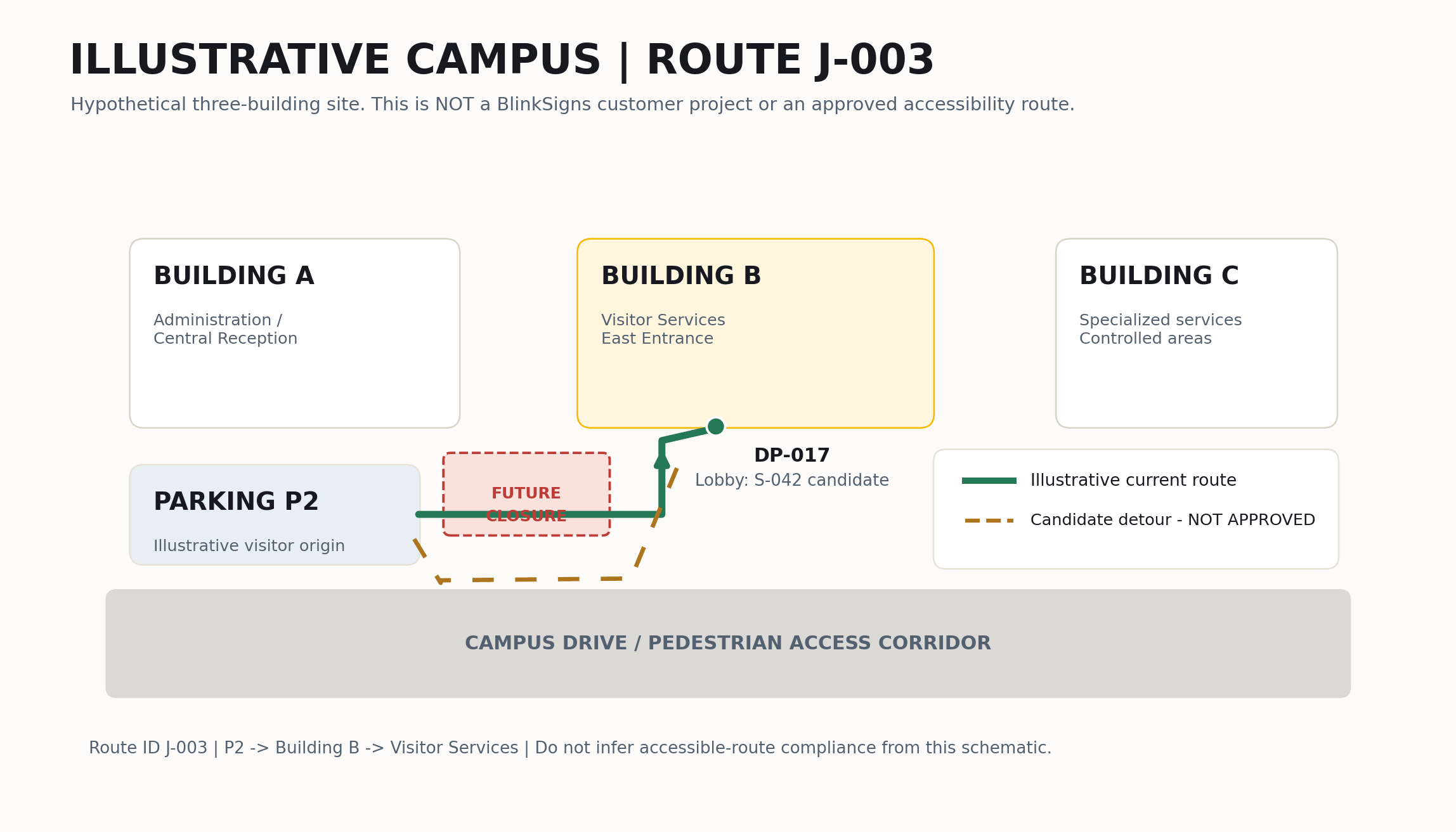
Mapping pedestrian routes and potential detours.
BlinkSigns’ interior wayfinding signage capabilities are relevant to this implementation stage, where approved information requirements are translated into physical directional and identification products.
Working Template: Download the Wayfinding Traceability Workbook (.xlsx) to log audit findings, map origin-to-destination journeys, manage your destination naming register, and track route-to-sign approvals.
How Should Architecture and Wayfinding Signage Work Together?
Architecture and signage should be coordinated because people navigate through physical layouts, not signs alone. Entrances, corridors, landmarks, lighting, vertical circulation, and building connections all influence how easily navigation information can be understood.
A sign should support the physical environment rather than attempt to compensate indefinitely for fundamental circulation problems.
Use architecture to reinforce orientation
Distinct entrances, recognizable reception areas, consistent corridor layouts, and clearly identified elevator lobbies can provide useful navigation cues.
These features may help people understand their location before reading a directional sign.
Wayfinding information should reinforce those cues rather than conflict with them.
For example, a prominently visible entrance may be a useful destination reference, while an entrance hidden behind an unrelated building feature may require additional orientation support.
Recognize problems signage cannot solve
Some navigation difficulties result from physical conditions.
A corridor may terminate unexpectedly, an entrance may be inaccessible from the preferred approach, or a connection between buildings may involve an unintuitive change in floor level.
Adding more signs may clarify the available route, but it cannot necessarily eliminate the underlying problem.
The Visible Language study on map design for complex architecture found that maps could assist navigation but had limitations when architectural barriers remained.
This supports the need to distinguish information-design problems from circulation and architectural problems.
Establish escalation criteria
A navigation problem should be escalated beyond signage when the physical environment or operational arrangement prevents the proposed route from functioning appropriately.
| Observed problem | Likely review |
| Conflicting destination names | Information governance |
| Missing directional information | Wayfinding design |
| Sign hidden by an obstruction | Placement and architectural coordination |
| Inaccessible connection | Qualified accessibility and architectural review |
| Restricted route presented as public | Operations and security |
| Entrance difficult to identify | Architectural and wayfinding coordination |
| Temporary closure affecting required circulation | Facility operations and relevant technical review |
The master plan should document the escalation and its responsible owner.
Verify installation locations in the field
Sign-location drawings should be reviewed against actual site conditions.
A proposed sign may conflict with equipment, doors, architectural features, lighting, or required clearances.
Exterior signs may also require review of traffic conditions, structural supports, permits, and site-specific restrictions.
BlinkSigns offers exterior wayfinding signage for commercial and institutional environments, including building identification and directional applications. The final design and installation scope should reflect approved site conditions.
What Accessibility and Safety Requirements Should a Wayfinding Master Plan Consider?
A wayfinding master plan should identify the accessibility, circulation, traffic control, and life safety requirements relevant to the facility. These requirements should be evaluated according to the intended route, sign function, physical environment, and applicable regulations, with technical determinations assigned to qualified professionals.
Accessibility should influence route planning before final signage locations are selected.
Physical signage accessibility
Under the 2010 ADA Standards, permanent room and space identification signs generally have applicable tactile and visual requirements where provided. Interior directional and informational signs generally require appropriate visual characteristics but do not require tactile text.
The U.S. Access Board’s official Chapter 7 guide explains these distinctions and the relevant exceptions.
Not every directional sign requires Braille.
The applicable requirements depend on what the sign identifies or communicates.
The Standards also address tactile sign placement, character characteristics, finish, and contrast. They do not establish one universal numerical contrast percentage for every physical sign.
Accessible routes must be verified
An accessible route is not necessarily the shortest route.
The master plan should identify how relevant origins and destinations connect through appropriate accessible circulation.
This may involve entrances, pedestrian routes, ramps, elevators, and other building elements.
A proposed route should not be labeled accessible until the necessary physical and regulatory review has been completed.
For the illustrative campus, the candidate perimeter route around the courtyard remains under review.
The project team must determine whether it provides an appropriate connection to Building B before using it in temporary visitor instructions.
Inclusive navigation beyond minimum sign requirements
Wayfinding should consider practical usability for people with different mobility, vision, language, and cognitive needs.
Clear terminology, understandable information hierarchy, appropriate symbols, readable layouts, and consistent confirmation points may improve usability.
Multilingual information may be appropriate where the facility serves visitors with different language needs. Translation should be accurate and consistent with approved destination names.
Color should not be the only method for communicating essential route distinctions.
Testing should include relevant user groups rather than assuming that one participant population represents everyone who uses the facility.
Exterior traffic-control requirements
Some campus signs may function as traffic-control devices and require review under applicable roadway standards.
The Federal Highway Administration’s current national MUTCD is the 11th Edition with Revision 1, dated December 2025 and effective March 5, 2026. It addresses traffic-control devices on relevant roads and facilities open to public travel.
The MUTCD does not automatically govern ordinary interior wayfinding signs.
State adoption, local requirements, and the sign’s actual function must be considered.
Digital accessibility
Digital directories, maps, and navigation applications require separate accessibility evaluation.
The W3C’s WCAG 2.2 provides a technical framework for accessible web content, including considerations relevant to visual presentation, navigation, and interaction.
The applicable legal requirements depend on the facility and technology. Physical sign compliance does not establish digital accessibility compliance.
Life-safety and emergency information
Ordinary wayfinding information must not conflict with required exit signs, emergency circulation, or other life-safety requirements.
Temporary visitor detours should be coordinated with applicable operational and safety procedures.
A wayfinding master plan does not authorize changes to an emergency evacuation route or the overriding of required safety information.
What Documents Should a Wayfinding Master Plan Include?
A wayfinding master plan should include the documents needed to establish the navigation strategy, define implementation requirements, and maintain the completed system. Strategic planning documents should be distinguished from detailed sign programming and operational records.
The document package should be proportionate to project complexity.
Strategic documents
Strategic documentation generally includes the project scope, existing-conditions audit, user journeys, circulation strategy, destination hierarchy, information requirements, signage standards, and governance structure.
These records explain how the system should function.
Implementation documents
Implementation records translate the strategy into installable requirements.
The VA Signage Design Manual identifies location plans, message schedules, and sign drawings as the principal signage programming documents.
Additional project records may include material specifications, sample approvals, installation plans, and technical review documentation.
Operational documents
Operational records support future updates.
These may include an as-installed sign inventory, maintenance instructions, approved destination register, inspection records, and change-control log.
Master-plan deliverables matrix
| Deliverable | Strategic phase | Implementation phase | Operations |
| Project brief | Approve | Reference | Review as needed |
| Existing-condition audit | Prepare | Verify affected conditions | Update |
| Journey register | Establish | Test | Reassess |
| Destination hierarchy | Approve | Apply | Maintain |
| Circulation strategy | Establish | Verify | Update after changes |
| Decision-point register | Identify | Confirm | Maintain |
| Signage standards | Establish | Apply | Maintain |
| Sign-location plans | Conceptual where needed | Finalize | Archive as-installed |
| Message schedules | Naming principles | Finalize | Update |
| Fabrication drawings | Not normally final | Prepare and approve | Archive |
| Installation records | Define requirements | Complete | Retain |
| Route-test records | Baseline | Commissioning | Reassessment |
| Change register | Governance | Establish | Maintain |
These are recommended project deliverables, not universal legal requirements.
Document ownership and version control
Every controlled document should identify its owner, revision, approval status, and effective date.
Superseded documents should remain distinguishable from current approved records.
This is particularly important when several teams work on drawings, sign messages, and building changes simultaneously.
A sign should not be fabricated from an outdated schedule merely because that file remains accessible.
Determine phase completeness
A phase should be accepted when its required decisions and evidence are complete.
For example, strategic planning may be accepted before every future sign has been programmed, provided the remaining implementation requirements are documented and assigned.
Fabrication should not proceed while critical messages or technical conditions remain unresolved.
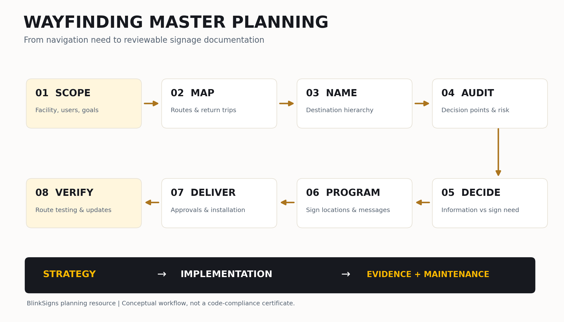
Eight-step workflow for wayfinding master planning.
Planning Reference: Download the Wayfinding Deliverables & Approval Gates Reference (PDF) for a printable breakdown of strategic, implementation, and operational documentation requirements across project phases.
How Do You Develop a Consistent Wayfinding Signage Design System?
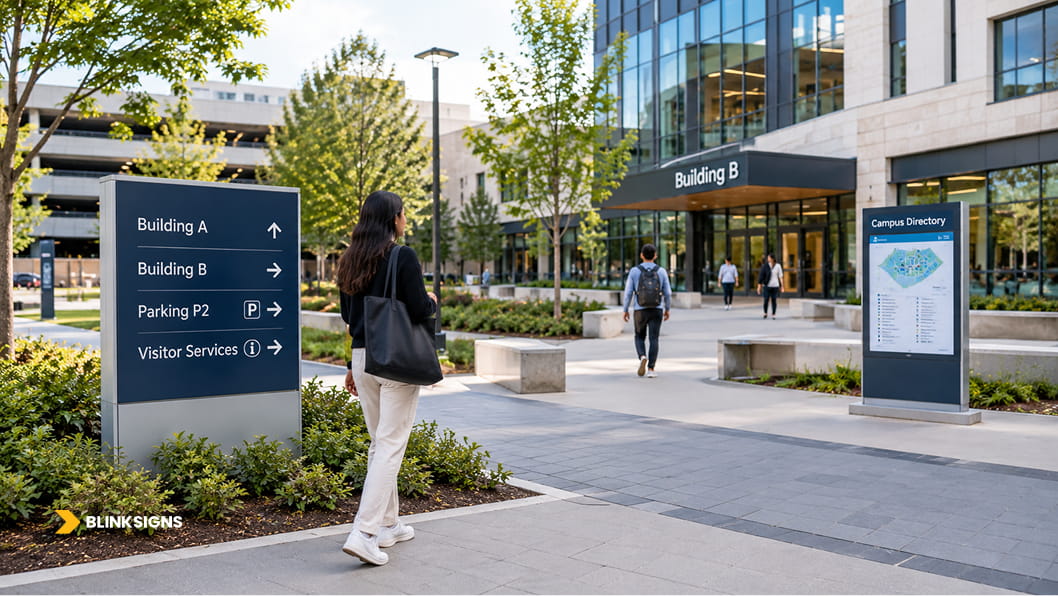
Cohesive outdoor directional signage and directories.
A wayfinding signage design system establishes the functional, visual, and construction principles used across the facility’s signs. It should support consistent navigation while allowing appropriate adaptations for different locations and technical requirements.
The design system should follow the approved destination hierarchy.
Define sign families
Common sign families include campus identification, building identification, directional signs, directories, confirmation signs, department identification, permanent room signs, and temporary navigation signs.
Each family should have a defined purpose.
| Sign family | Primary function | Key review |
| Campus identification | Establish facility identity | Visibility and naming |
| Building identification | Confirm building or entrance | Consistency with route information |
| Exterior directional | Guide site movement | Approach conditions and applicable requirements |
| Interior directional | Support route choices | Message clarity and placement |
| Confirmation | Reinforce selected route | Continuity |
| Directory | Organize destinations | Information hierarchy |
| Department identification | Confirm arrival | Approved terminology |
| Room identification | Identify permanent spaces | Applicable tactile and visual requirements |
| Temporary directional | Communicate changed routes | Accuracy, approval, and removal |
Establish visual standards
Typography, arrows, symbols, colors, and layout conventions should be consistent.
The standards should consider legibility, information hierarchy, viewing conditions, and applicable accessibility requirements.
Color may reinforce a building’s or zone’s identity, but essential information should not depend on color alone.
Develop material and construction specifications
Materials should be selected based on environmental conditions, mounting requirements, cleaning compatibility, anticipated updates, and maintenance needs.
A directory with frequently changing destinations may benefit from a replaceable-message system.
An exterior sign may require different structural and environmental considerations.
Universal claims about material lifespans should be avoided in the absence of product-specific evidence.
Evaluate samples before full production
Representative signs should be reviewed at an appropriate scale and under realistic viewing conditions.
A useful sample review should examine the message, finish, legibility, construction, and installation method.
Where the project includes a large number of similar signs, resolving problems in representative samples can prevent repeated errors.
How Do You Coordinate Digital and Physical Wayfinding?
Digital and physical wayfinding should communicate consistent destination names and routes through clearly defined information ownership and update procedures. Digital tools may support maps, searchable directories, and route planning, while physical signs provide information within the built environment.
Neither should be assumed to completely replace the other.
Establish a shared destination source
A controlled destination register should serve as the approved reference for names and locations.
Physical signs, digital directories, visitor instructions, and relevant online maps should use that information consistently.
The facility should identify who may approve changes and which systems must be updated.
Distinguish digital capabilities
Static maps, searchable kiosks, mobile directions, and real-time indoor positioning systems offer different functions.
A kiosk displaying a map does not automatically provide real-time visitor positioning.
Technology capabilities should be verified against the actual selected platform.
Plan for update failures
A digital route may remain outdated if a department moves, an entrance closes, or a data update fails.
The facility should establish how discrepancies are reported, corrected, and communicated.
When a route becomes unavailable, affected digital information should be reviewed alongside physical signs and operational instructions.
Digital integration should not be described as automatic unless the systems actually support it.
Preserve non-digital navigation
Visitors should not need to rely exclusively on a personal smartphone to understand essential public routes.
Physical signs and available assistance remain important at entrances, intersections, elevators, and destinations.
BlinkSigns’ SignTrax supports signage project tracking and should not be confused with indoor positioning or visitor navigation software.
How Do You Plan Procurement and Phased Implementation?
Wayfinding procurement should translate the approved master plan into a defined project scope, supplier responsibilities, technical documents, approval gates, and installation requirements. Implementation should be phased in response to operational constraints and the need to maintain accurate navigation during changes.
Prepare a complete RFP scope
A wayfinding RFP should identify the facilities involved, the project objectives, the available drawings, the destination hierarchy, the sign families, the accessibility considerations, the installation conditions, and the expected deliverables.
It should distinguish planning services from fabrication and installation.
Evaluate suppliers consistently
Proposals should be compared against the same requirements.
| Evaluation category | Buyer consideration |
| Scope completeness | Are all requested services included? |
| Relevant experience | Does the supplier demonstrate experience with comparable requirements? |
| Technical coordination | Are specialist review responsibilities clear? |
| Documentation | Are approvals and revisions controlled? |
| Fabrication | Are materials and production requirements defined? |
| Installation | Are site access and operational conditions addressed? |
| Quality assurance | Are inspection and correction procedures documented? |
| Maintenance | Are replacements and future updates considered? |
| Exclusions | Are responsibilities not included in the proposal clear? |
The lowest fabrication proposal is not necessarily equivalent to a proposal that includes surveys, design development, installation, and closeout.
Project costs should be evaluated against the actual scope rather than generalized price claims.
Establish implementation gates
| Gate | Required evidence | Decision |
| Strategic approval | Accepted routes and destination hierarchy | Planning accepted |
| Design approval | Reviewed sign standards and proposed interventions | Design accepted |
| Technical approval | Relevant specialist reviews and approved documentation | Implementation conditions accepted |
| Fabrication approval | Final messages, drawings, materials, and samples | Production authorized |
| Installation approval | Site access and required work controls | Installation authorized |
| Commissioning | Inspections and route tests | Acceptance decision |
These gates are recommended project controls, not universal regulatory requirements.
Plan temporary routes and rollback procedures
Temporary navigation should be established before construction changes normal circulation.
The facility should identify affected signs, approve alternative routes, and determine how changes will be communicated.
If a temporary route is unsuitable or becomes unavailable, the project team should have a procedure to stop its use and issue corrected instructions.
For the illustrative campus, renovation-related change C-006 affects the approach to Building B from Parking P2.
The proposed perimeter route remains subject to operational and accessibility review.
Until approval is obtained, no temporary sign should direct visitors along that route.
Candidate S-042 at DP-017 should also be reviewed against the approved temporary circulation arrangement.
BlinkSigns Case Study: RACC Campus Parking and Wayfinding Signage
The RACC campus signage project in Reading, Pennsylvania, demonstrates how coordinated sign specifications, location planning, and documented revisions support consistent navigation across multiple parking areas. The project illustrates the implementation side of wayfinding planning, where destination identification and directional requirements are translated into specific physical signage.
Project overview
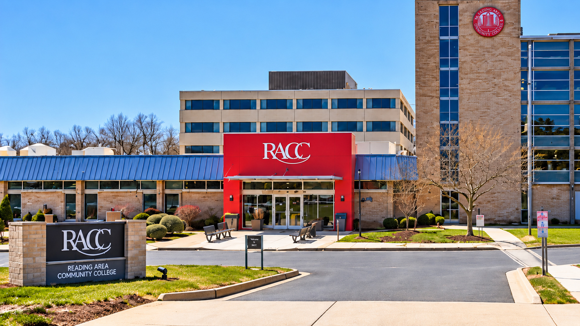
Campus entrance featuring exterior dimensional signage.
BlinkSigns coordinated with Pennbid on a parking signage project for the RACC campus at 10 South Second Street in Reading, Pennsylvania.
The project focused on establishing consistent parking identification, directional information, and campus branding for visitors, faculty, and staff.
The published signage package included two complementary sign families: illuminated pylon signs identifying parking areas and non-illuminated directional signs communicating lot identifiers and route choices.
What BlinkSigns delivered
| Project component | Documented implementation | Wayfinding significance |
| Parking identification | Nine illuminated, four-sided pylon signs | Establishes recognizable parking destinations |
| Directional wayfinding | Five non-illuminated signs with parking lot letters and arrows | Communicates route choices between parking areas |
| Signage construction | Aluminum cabinets, structural supports, and coordinated exterior finishes | Establishes consistent fabrication specifications |
| Visual identity | RACC branding, coordinated red and gray finishes, and white graphics | Reinforces recognition across different sign types |
| Location revisions | Documented adjustments to directional sign locations and arrow information | Demonstrates the need to maintain accurate implementation records |
| Scope revisions | Two additional Lot A pylons increased the specified quantity from seven to nine | Shows how project changes affect quantities and documentation |
The illuminated pylons were specified at 8 feet 6 inches tall, with four-sided cabinets designed to display parking identification and campus branding from multiple approaches.
The five directional signs incorporated parking lot letters and arrows, with non-illuminated aluminum construction and coordinated visual specifications.
How project revisions influenced the signage program
One of the most useful aspects of the published case study is its documentation of changes during project development.
The signage package originally included seven pylon signs. Two additional Lot A pylons increased the specified quantity to nine.
The project documentation also records a revised location for the Lot E directional arrow, an adjustment to the Type F sign location, and changes to certain finish specifications.
These details illustrate why coordinated signage projects require controlled drawings, approved message information, and reliable revision records.
A change affecting an arrow or sign location may appear minor when viewed individually. However, it can influence how visitors interpret a route and how the sign is fabricated or installed.
Similarly, adding two parking identification signs changes the production scope and requires corresponding updates to the relevant specifications and location records.
What complex-facility owners can learn from this project
The RACC project provides three practical lessons for facilities planning a wayfinding signage program.
First, identification and directional signage serve complementary purposes. Parking pylons help users locate destinations, while directional signs indicate which route to take.
Second, consistency requires more than a shared visual design. Messages, sign locations, quantities, materials, and installation requirements must remain coordinated.
Third, project revisions should be traceable. Changes to sign quantities, directional arrows, and installation locations should be reflected in the approved project documentation before the affected work proceeds.
The published RACC case study documents the signage package and its revisions. It does not provide a complete wayfinding master-plan report or measured before-and-after navigation results.
Download the RACC Project Evidence Note (PDF)
Nevertheless, the project demonstrates an important implementation principle: a successful signage program depends on translating navigation requirements into coordinated, reviewable, and maintainable physical signage documentation.
Facilities developing a wayfinding master plan should establish these documentation and approval requirements before authorizing fabrication.
How Do You Test and Commission a Wayfinding System?
Wayfinding commissioning should verify that installed signs match approved requirements and that representative users can complete important navigation journeys. The process should assess the quality of the physical installation, the accuracy of information, route continuity, and usability.
Installation completion alone does not establish that the overall navigation system works.
Establish a reproducible test protocol
Before testing, the project team should define the journey, starting point, destination, participant group, available information, assistance rules, and observation method.
Participants should receive realistic instructions.
Their familiarity with the facility should be recorded.
Where appropriate, the test should include people with different navigation needs.
The team should also establish how observations will be recorded without unnecessarily collecting personal information.
Measure navigation performance
| Metric | Definition |
| Route completion | Successful arrivals divided by valid attempts |
| Wrong turns | Incorrect route decisions |
| Navigation time | Time from defined origin to destination |
| Assistance requests | Requests recorded during testing |
| Destination errors | Arrivals at incorrect locations |
| Sign accuracy | Current approved signs divided by signs audited |
| Accessible route completion | Successful completion of verified relevant routes |
The route completion rate may be calculated as:
Route completion rate (%) = Successful route attempts ÷ Total valid attempts × 100
A journey completed with assistance may be recorded separately from one completed independently.
Testing conditions should be documented so that future comparisons remain meaningful.
Establish corrective-action criteria
The facility should determine which findings prevent acceptance and which can be addressed through an approved improvement program.
A contradictory sign at a critical decision point may require correction before the route is accepted.
A minor presentation issue may be handled differently, depending on its actual effect and applicable requirements.
The project should not invent a universal acceptable wrong-turn percentage.
Complete the illustrative journey test
Commissioning task T-003 evaluates journey J-003 from Parking P2 to Visitor Services in Building B.
The observer should verify that the visitor encounters appropriate information along the route and can identify the correct direction at DP-017.
Candidate sign S-042 should be inspected against its approved message and installation documentation.
If the visitor becomes confused, the observation should be linked to the relevant decision point and investigated.
No route-completion results are assumed in this example.
Close corrective actions
Each finding should have an owner, proposed correction, and verification status.
After relevant changes, the affected route should be tested again where appropriate.
The final acceptance record should distinguish physical installation checks from navigation usability and regulatory review.
Field Testing Template: Download the Wayfinding Field Walkthrough & Commissioning Guide for reproducible route-test scripts, observation logs, and corrective-action sign-off sheets.
How Do You Maintain a Wayfinding Master Plan Over Time?
A wayfinding master plan should be maintained through controlled destination information, updated signage records, defined review responsibilities, and documented changes to routes or facilities. Renovations, department relocations, entrance changes, and operational updates can make previously accurate directions misleading.
Maintenance should address both physical signs and the accuracy of information.
Establish maintenance triggers
A wayfinding review should be initiated when a relevant change occurs.
Examples include department relocation, entrance closure, building expansion, parking changes, altered circulation, or a change in destination terminology.
Scheduled inspections can identify damaged signs and outdated information, but event-driven reviews remain important.
Maintain an as-installed inventory
The final sign inventory should record actual installations rather than only original design intentions.
Useful fields include sign ID, location, message, sign family, drawing reference, installation record, and maintenance status.
Field changes should be incorporated into the controlled record.
Use a change-control register
The illustrative campus’s renovation is recorded as change C-006.
| Field | Illustrative record |
| Change ID | C-006 |
| Change type | Temporary pedestrian route closure |
| Affected journey | J-003 |
| Origin | Parking P2 |
| Destination | Visitor Services, Building B |
| Affected approach | East courtyard connection |
| Proposed alternative | Perimeter pedestrian route under review |
| Related decision point | DP-017 |
| Related candidate sign | S-042 |
| Approval status | Pending route review |
| Required verification | Test approved temporary route |
The record does not imply that the alternative route has been approved.
Once the renovation is completed, temporary signs should be reviewed for removal and the permanent route should be verified again.
Maintain standards across multiple facilities
Organizations operating multiple sites may benefit from shared signage standards, naming conventions, and documentation practices.
However, each facility must account for its own architecture, operational requirements, and applicable regulations.
Centralized standards should support consistency without eliminating necessary local review.
Wayfinding Master Plan Checklist
A wayfinding master plan is ready to proceed to implementation once its objectives, key journeys, destination hierarchy, circulation strategy, design standards, technical review responsibilities, and necessary documentation have been approved at the appropriate project stage.
The following checklist provides a practical readiness framework.
| Requirement | Verification evidence | Responsible owner | Status |
| Project objectives defined | Approved project brief | Project owner | Pending |
| Facility boundaries documented | Site inventory | Facilities | Pending |
| User groups identified | Stakeholder record | Operations | Pending |
| Existing conditions audited | Audit report | Project team | Pending |
| Origin/destination inventory completed | Journey register | Wayfinding lead | Pending |
| Primary journeys mapped | Route diagrams | Wayfinding team | Pending |
| Return journeys reviewed | Route inventory | Operations | Pending |
| Destination hierarchy approved | Naming register | Authorized owner | Pending |
| Decision points identified | Decision-point register | Wayfinding team | Pending |
| Architectural barriers reviewed | Coordination record | Design team | Pending |
| Accessibility requirements evaluated | Qualified review | Responsible specialist | Pending |
| Safety requirements identified | Technical review | Responsible specialist | Pending |
| Signage design standards approved | Standards manual | Design authority | Pending |
| Physical/digital information ownership established | Governance record | Facility owner | Pending |
| Implementation scope defined | RFP and project documents | Project manager | Pending |
| Fabrication approval process established | Approval matrix | Project owner | Pending |
| Temporary route planning completed | Phasing plan | Operations | Pending |
| Commissioning procedures defined | Test plan | Project team | Pending |
| Maintenance ownership assigned | Operational record | Facilities | Pending |
| Change-control procedure established | Change register | Facility owner | Pending |
These are example status values for a planning template, not findings from a real facility.
How should incomplete items be handled?
Outstanding requirements should be assessed based on their impact on the next project phase.
A final fabrication detail may be scheduled for later implementation.
An unresolved destination name or unverified route may prevent approval of dependent signage.
The readiness checklist should identify these dependencies rather than treating every incomplete item as equally important.
Download the Printable Wayfinding Readiness Checklist (PDF) for stakeholder sign-off reviews.
Frequently Asked Questions About Wayfinding Master Plans
Wayfinding master planning raises practical questions about project scope, documentation, accessibility, supplier responsibilities, digital systems, and long-term maintenance. The answers below clarify how facility teams can approach these decisions.
What is the difference between a wayfinding master plan and a sign schedule?
A wayfinding master plan establishes navigation strategy, destination hierarchy, circulation principles, and signage standards. A sign schedule documents individual physical signs and their implementation details.
Detailed sign programming should follow the approved strategy.
How long does it take to prepare a wayfinding master plan?
The required time depends on the facility’s size and complexity, stakeholder coordination, existing documentation, and the field research required.
A reliable project schedule should be developed after the scope has been assessed, rather than assumed based on a universal timeframe.
Does every building need a comprehensive wayfinding master plan?
No. A smaller building with simple circulation may require only a targeted navigation assessment and coordinated sign plan.
A complex campus with multiple buildings, routes, or conflicting information may benefit from comprehensive master planning.
Can a facility improve wayfinding without replacing every sign?
Yes. Correcting destination names, updating directories, improving placement, or adding missing confirmation information may resolve certain problems.
An audit should determine the appropriate intervention before recommending widespread replacement.
Who should approve wayfinding signage?
The facility owner and project team should define approval responsibilities through the project’s contractual and governance structure.
Destination names, design documents, technical requirements, and fabrication authorizations may require different reviewers.
How are accessible routes incorporated into the master plan?
Accessible routes should be identified through appropriate technical review and accurately reflected in navigation information.
A proposed route should not be described as accessible merely because it appears continuous on a plan.
What information belongs in a wayfinding sign schedule?
A sign schedule may include sign ID, location, message, sign family, dimensions, material, mounting condition, drawing reference, accessibility review, and approval status.
The precise fields depend on project scope.
Do wayfinding master plans require digital navigation?
No. Digital maps and directories may complement physical signage, but they are not universal requirements.
Where digital navigation is provided, the facility should maintain consistent destination information and appropriate accessibility review.
How is wayfinding effectiveness measured?
Wayfinding effectiveness can be evaluated through representative route tests, destination-arrival success, wrong turns, assistance requests, and information-accuracy audits.
Results should be interpreted according to the actual test conditions.
When should a signage company become involved?
A signage company can contribute when navigation requirements begin translating into physical sign types, specifications, production documents, and installation plans.
Early coordination can help identify fabrication and site constraints, but specialist responsibilities should remain clearly defined.
Building a Wayfinding System That Can Be Implemented and Maintained
A wayfinding master plan should connect the facility’s physical environment with its destination information, navigation routes, signage requirements, and ongoing management responsibilities.
Its value extends beyond determining where signs belong.
A strong master plan establishes why information is needed, how it should be communicated, who must approve it, and how the resulting system will be verified.
The illustrative three-building campus demonstrates that process.
An audit finding identifies inconsistent signage. A journey record connects Parking P2 with Visitor Services. A decision-point register identifies where a navigation choice occurs. An approved naming decision establishes consistent terminology. A proposed sign is linked to those requirements, while fabrication and installation remain subject to appropriate approvals.
When renovation changes the pedestrian approach, the same records help identify which routes and signs require review.
The objective is not simply to create a coordinated collection of signs. It is to establish a navigation system that can be understood, implemented, tested, and maintained as the facility evolves.
Plan Your Wayfinding Signage Project With BlinkSigns
BlinkSigns supports commercial and institutional signage projects through site surveys, design consultation, fabrication, installation, program management, and maintenance-related services.
For organizations planning a new facility or improving an existing navigation system, a project consultation should begin with the facility type, number of buildings, major destinations, known navigation problems, available drawings, and anticipated installation conditions.
These details help establish an appropriate scope for signage and identify which planning or technical responsibilities require coordination.
BlinkSigns’ healthcare signage capabilities and broader interior and exterior signage services offer relevant options for facilities that must implement approved wayfinding requirements.
Request a Wayfinding Signage Project Quote from BlinkSigns ↗